Click on this map view to see the maps of all the beaches in Mangalore and driving directions
Panambur Beach
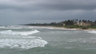
 This beach is situated on the Mangalore-Udupi highway (NH 17) to the left around 7 kms from the city. On the way to this beach you can see MCF (Mangalore Chemical Fertilizer) and Kudremukh Iron Ore Company.The Panambur beach is a popular Sunday outing spot among the locals. This beach is very near to the New Mangalore port, it is the harbor for many ships. Usually granites and grains are exported from this harbor. This is a beautiful clean beach attracting large number of visitors and tourists during summer vacation and other holidays. You can also view splendid ships sailing among the ups and down of the rough Arabian sea. Chat and snack stalls are available near the beach. One can see the shoreline stretching of all the way to Surathkal from here. The lighthouse of the Surathkal Beach can also been seen from this beach. City Buses with Route no. 2, 2A, 2C, 40A, 41A, 45, 45G, 53, 53A, 59 A short walk of 10 minutes from the bus stand is required to the beach.
From Hampankatta Signal, Hamankatta, Mangalore, Karnataka(12.8679155,74.842335) to Panambur beach, Karnataka(12.9366605,74.803993)
Driving Directions:
1.Straight (<100m) on Kmc Mercara Trunk Rd going toward Ks Rao Rd
2.1st Right onto Ks Rao Rd, go 0.6 km
3.Take Slight 3rd Right (past South Canara District Central Co op Bank on the right), go 0.2 km
4.Continue down M.G. Rd: 1.7 km (Past Canara Bank on the right)
5.At Lady Hill Cir, take 3rd exit onto Lady Hill Cir, go <100m overall
6.1st Left onto Kuloor Ferry Rd, go 2.4 km
7.Continue down NH17 Hwy: 1.9 km (Past Kottara Chowki (Police Station) on the left)
8.Continue down Koolur Bridge Rd(NH17 Hwy): 0.2 km
9.Continue down NH17 Hwy: 1.8 km
10.Left (past Syndicate Bank on the left) onto Beach Rd, go 0.9 km
11.Continue down : 0.3 km
12.Arrive at destination
Driving Directions:
1.Straight (<100m) on Kmc Mercara Trunk Rd going toward Ks Rao Rd
2.1st Right onto Ks Rao Rd, go 0.6 km
3.Take Slight 3rd Right (past South Canara District Central Co op Bank on the right), go 0.2 km
4.Continue down M.G. Rd: 1.1 km (Past Canara Bank on the right)
5.Right (past Corporation Bank on the left) onto Konchady Rd, go 0.2 km
6.Take Slight 1st Left (past Bharat Mall on the left), go 1.6 km
7.Left onto NH17 Hwy, go 3.4 km
8.Continue down Koolur Bridge Rd(NH17 Hwy): 0.2 km
9.Continue down NH17 Hwy: 10 km
10.Take Left (past NITK Kannada Medium School on the right), go 0.4 km
11.Arrive at destination
You Tube – Surathkal Beach
Summer Sands – Ullal Beach
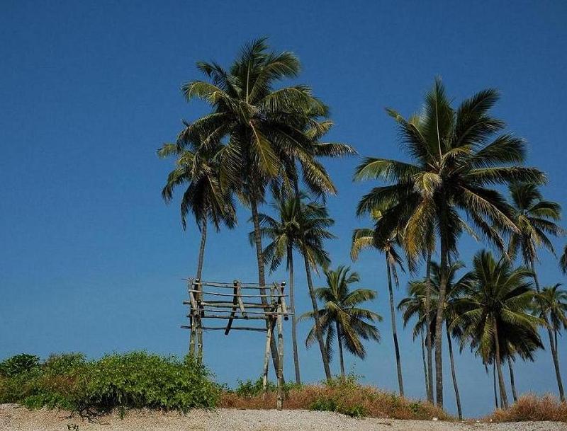
 Summer Sands Beach Resort situated at Ullal Beach is around 15 Kms away from Mangalore to the South. Set in 14 acres of casuarina groves, has well furnished cottages and makes a pleasant getaway from the city. Restaurant servers good seafood to satisfy one’s appetite. Ullal Town was known as Capital of Tulu Kingdom and was ruled by Brave Queen Rani Abbakka Devi in the middle of 15th Century and fought for Independence against Portuguese. The Famous religious centers such as Sayyed Madani darga, Somanatheshwara Temple and St. Sebastian Church are located in this tow. For more info, visit summer sands web site
To get there take the City Bus No 44, 44D.
Location:
From: Hampankatta Signal (Cletus Pinto), Hamankatta, Mangalore, Karnataka(12.8679155,74.842335) to Summer Sands Beach Resort, Kotekara, Karnataka(12.803327,74.8439635)
Driving Directions:
1.Straight (<100m) on Kmc Mercara Trunk Rd going toward Ks Rao Rd
2.1st Left onto Falneer Rd, go 0.1 km
3.Take Slight 2nd Right (past Government Hospital on the right), go 0.3 km
4.2nd Left onto Nandigudda Rd, go 1.5 km
5.At Nandigudda Cir, take 2nd exit, go 0.5 km overall
6.At Marnamikatta Cir, take 1st exit onto Jeppu Ferry Rd, go 0.5 km overall
7.Take Slight 5th Left, go 0.3 km
8.Take 3rd Right, go 0.6 km
9.1st Right (past Adi Maheshwar Temple on the left) onto Kerala Rd(NH17 Hwy), go 3.5 km
10.Take Right (past Neta Ji Lai Lapa Hospital on the left), go 1.3 km
11.Take Left, go 0.4 km
12.Take 5th Right, go <100m
13.Take 1st Left (past Alfa Sports Club on the left), go <100m
14.Take 1st Right (past Alfa Sports Club on the left), go 0.3 km
15.Take 2nd Left, go 0.7 km
16.Take 5th Right, go <100m
17.Arrive at destination
Someshwara Beach Mangalore
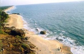
 It is 9 Kms to the south of Mangalore, and 1/2 Km from the Someshwara Bus stand, this beach is well known for the large rocks called “Rudra Shile”. The historical Somanath Temple constructed during the regime of the famous queen “Raani Abbakka Devi is situated in the north side. To get there take the City Bus No 44A from Hampankatta bus stand.
Driving Directions:
1.Straight (<100m) on Kmc Mercara Trunk Rd going toward Ks Rao Rd
2.1st Left onto Falneer Rd, go 0.1 km
3.Take Slight 2nd Right (past Government Hospital on the right), go 0.3 km
4.2nd Left onto Nandigudda Rd, go 1.5 km
5.At Nandigudda Cir, take 2nd exit, go 0.5 km overall
6.At Marnamikatta Cir, take 1st exit onto Jeppu Ferry Rd, go 0.5 km overall
7.Take Slight 5th Left, go 0.3 km
8.Take 3rd Right, go 0.6 km
9.1st Right (past Adi Maheshwar Temple on the left) onto Kerala Rd(NH17 Hwy), go 4.1 km
10.Take Right, go 0.1 km
11.Take Slight 1st Left, go 1.5 km
12.Take 4th Right, go 0.3 km
13.Take 4th Left, go 0.1 km
14.Take 1st Right, go 0.3 km
15.Arrive at destination
Thanner Bavi Beach, Mangalore
This beach is also situated on the Mangalore-Udupi highway (NH 17) to the left around 6 kms from the city. You will come across Kudremukh Iron Ore Company on the way to this beach, from the side walls you can have a look at the Iron Ore company. The special attraction of this beach is the boating facility. Boating is open to public only during summer and during public holidays. You can take a panoramic boat ride through the back waters of the Arabian sea. To get there take the City Bus No 1A from Hampankatta bus stand.
Just a boat ride away from St. Mary`s Island around 66 Kilometers from Mangalore.This beach is surrounded by the deep Arabian Sea and it is very beautiful during sun set.
Maravanthe lies about 9 km east of Kundapur, along the sea coast. It is an enchanting place, where on the western side, the Arabian sea is stretching, while on the eastern side, runs the Sauparnika river and in between them passes the west coast road with the Kudachadri Hills in the backdrop.
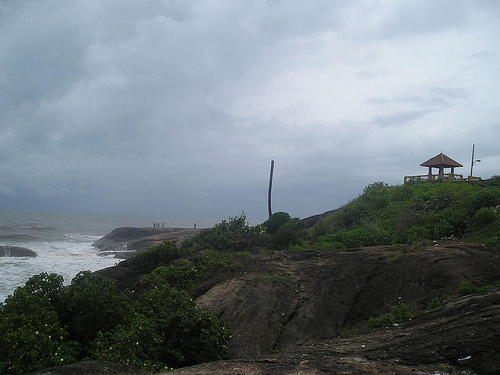
Kaup Beach is located 12 km south of Udupi. It is situated on the coastal belt. The Kaup beach is one of the most beautiful beaches. Its placement is perfect. The beach with the 100 ft high lighthouse on the rocks is a photographer’s paradise. The beach is a serene place with nature’s beauty in abundance. The sound of the waves caresses the breeze sensuously. A must be visited place for romantic couples. These are the reasons that Kaup Beach is a tourist attraction.
A walk along the rambling white sand beach and the cool blue water of the sea renders a remedial result for wore out souls.
